
 Continue with onX Maps
 Continue with Facebook


 Intermediate

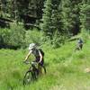
“This trail marks the beginning section of the 142 mile-long Tabeguache Trail. ”


15.8
Miles25.5
KMDoubletrack
 Intermediate
Local Club: Colorado Plateau Mountain Bike Association - Uncompahgre Chapter
Land Manager: BLM Colorado - Uncompahgre Field Office
 Lower 8
7.4 mi 11.8 km • 635' Up 193.42 m Up • 634' Down 193.33 m Down

 Sidewinder Loop
38.5 mi 61.9 km • 2,966' Up 904.06 m Up • 2,947' Down 898.21 m Down
 Sidewinder Trail
18.6 mi 29.9 km • 2,864' Up 872.99 m Up • 2,048' Down 624.14 m Down
Orchard…, CO
 Cerro Summit Trail System
1.6 mi 2.6 km • 108' Up 33.04 m Up • 139' Down 42.24 m Down
47 Trail (403)
9.8 mi 15.8 km • 837' Up 255.03 m Up • 1,294' Down 394.48 m Down
Dennis Weaver Memorial Park
3.1 mi 5.0 km • 291' Up 88.79 m Up • 303' Down 92.36 m Down


0 Comments