
 Continue with onX Maps
 Continue with Facebook


 Difficult


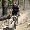
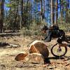
“A rough and technical trail much of which lies in or criss-crosses a stream bed. ”


0.9
Miles1.5
KMSingletrack
 Difficult
Land Manager: USFS - Prescott National Forest Office
 Goldwater Lakes Out-and-Back
13.1 mi 21.1 km • 1,273' Up 388.01 m Up • 1,273' Down 387.99 m Down
 Prescott, AZ
 Mt. Francis Loop
23.4 mi 37.7 km • 2,213' Up 674.66 m Up • 2,244' Down 684.08 m Down
 Smith Ravine & Spruce Mtn.
17.5 mi 28.1 km • 3,488' Up 1063.26 m Up • 3,501' Down 1066.96 m Down
Constellation Trails
3.0 mi 4.9 km • 368' Up 112.28 m Up • 343' Down 104.42 m Down
Painted Rock Loop
13.2 mi 21.2 km • 1,204' Up 367 m Up • 1,204' Down 367.03 m Down
Prescott, AZ
Pioneer Park NICA 2018 Race Course
6.5 mi 10.4 km • 417' Up 127.1 m Up • 419' Down 127.76 m Down
Prescott, AZ


2 Comments