
 Continue with onX Maps
 Continue with Facebook


 Easy
Easy

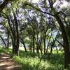
“A fire road leading to many area trails. ”


14.2
Miles22.8
KMDoubletrack
 Easy
Easy
Land Manager: California State Parks - Henry W. Coe State Park
 Mississippi Lake Ride
36.7 mi 59.1 km • 5,281' Up 1609.76 m Up • 5,281' Down 1609.71 m Down

 Harvey Bear Tour
14.0 mi 22.5 km • 1,082' Up 329.69 m Up • 1,082' Down 329.72 m Down
 Orestimba Coral-Dutch Trail Loop
14.6 mi 23.6 km • 2,282' Up 695.59 m Up • 2,282' Down 695.57 m Down
Morgan…, CA
Flat Frog to Middle Ridge (Henry W. Coe State Park)
10.4 mi 16.7 km • 2,226' Up 678.59 m Up • 2,226' Down 678.53 m Down
Mayfair Ranch-Longwall Canyon-Bald Peaks-Catamount
8.0 mi 12.9 km • 1,645' Up 501.34 m Up • 1,646' Down 501.84 m Down
Almaden…, CA
Almaden Quicksilver Loop
10.8 mi 17.3 km • 1,414' Up 430.87 m Up • 1,413' Down 430.75 m Down


0 Comments