
 Continue with onX Maps
 Continue with Facebook


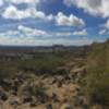
“One of the newly added trails (2015). ”


7.8
Miles12.6
KMSingletrack

Land Manager: City of Scottsdale
 Preserve Perimeter Loop
30.5 mi 49.1 km • 1,133' Up 345.31 m Up • 1,132' Down 345.07 m Down

 Carefree, AZ
West Side Loop
Carefree, AZ
West Side Loop
19.5 mi 31.3 km • 706' Up 215.08 m Up • 705' Down 215.01 m Down
Phoenix Sonoran Preserve North/South Loop
13.0 mi 20.9 km • 459' Up 140.02 m Up • 456' Down 139.1 m Down
 Taliesin Loop
8.4 mi 13.6 km • 560' Up 170.61 m Up • 562' Down 171.34 m Down
 Reach 11 Long Loop
18.1 mi 29.2 km • 168' Up 51.12 m Up • 167' Down 51.04 m Down
 Deem Hills Ridge Loop
5.2 mi 8.3 km • 839' Up 255.74 m Up • 839' Down 255.67 m Down


 All Clear


1 Comment