
 Continue with onX Maps
 Continue with Facebook


 Difficult

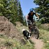
“A section of trail that goes through the Wagon Track area and can be combined with Big Sky Loop. ”


0.7
Miles1.2
KMSingletrack
 Difficult
Land Manager: BLM Colorado - San Luis Valley Field Office
 Sunshine Kitty - Rock Drops Loop
8.1 mi 13.0 km • 860' Up 262.1 m Up • 865' Down 263.54 m Down

 Del Norte, CO
 12 Hours of Penitence
17.0 mi 27.3 km • 1,670' Up 509.07 m Up • 1,673' Down 510 m Down
Del Norte, CO
Stone Quarry Tour
10.2 mi 16.3 km • 865' Up 263.56 m Up • 866' Down 263.97 m Down
Del Norte, CO
Middle Frisco Trail #879
12.6 mi 20.3 km • 2,484' Up 757.25 m Up • 2,483' Down 756.93 m Down
Del Norte, CO
Rainbow Trail #1336
98.1 mi 157.8 km • 14,891' Up 4538.67 m Up • 14,697' Down 4479.55 m Down
Colorado Trail: The Entire MTB Route - IMBA EPIC
549.3 mi 884.0 km • 71,117' Up 21676.5 m Up • 69,664' Down 21233.6 m Down
Roxboro…, CO


2 Comments