
 Continue with onX Maps
 Continue with Facebook


 Intermediate/Difficult

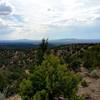
“A fun ride to an alpine lake with great views of the Sangre de Cristo mountains. ”


4.8
Miles7.8
KMSingletrack
 Intermediate/Difficult
Land Manager: USFS - Carson National Forest
 Questa - San Cristobal Loop
25.2 mi 40.5 km • 2,801' Up 853.73 m Up • 2,803' Down 854.23 m Down


 Cebolla Mesa Wanderer
14.2 mi 22.8 km • 882' Up 268.84 m Up • 878' Down 267.59 m Down
 South Boundary: 70 to Juan (Short Shuttle)
29.3 mi 47.1 km • 3,690' Up 1124.85 m Up • 4,965' Down 1513.47 m Down
Angel Fire, NM
Sierra de Don Fernando
4.6 mi 7.4 km • 530' Up 161.48 m Up • 533' Down 162.54 m Down
John Dunn's Heavy Horse
22.3 mi 35.9 km • 1,857' Up 566.04 m Up • 1,840' Down 560.69 m Down
Sage to Elliot Barker Loop
16.9 mi 27.3 km • 2,066' Up 629.73 m Up • 2,066' Down 629.65 m Down


1 Comment