
 Continue with onX Maps
 Continue with Facebook


 Easy/Intermediate

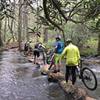
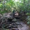
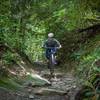
“A short, mellow trail that connects Conservation Road to Corn Mill Shoals. ”


0.6
Miles1.0
KMSingletrack
 Easy/Intermediate
Local Club: Pisgah Area SORBA
Land Manager: North Carolina Forest Service - Dupont State Forest
 Lake Imaging Lollipop
14.0 mi 22.6 km • 1,454' Up 443.09 m Up • 1,452' Down 442.67 m Down

 Brevard, NC
 Pisgah Stage Race - Stage 5
28.5 mi 45.8 km • 2,863' Up 872.78 m Up • 2,780' Down 847.39 m Down
Brevard, NC
Pisgah 111K
72.1 mi 116.0 km • 8,909' Up 2715.32 m Up • 8,903' Down 2713.64 m Down
Brevard, NC
Pisgah Stage Race - Stage 3
31.4 mi 50.5 km • 5,727' Up 1745.44 m Up • 5,728' Down 1745.87 m Down
Brevard, NC
Turkeypen Gap to Black Mountain Loop
23.3 mi 37.5 km • 3,568' Up 1087.56 m Up • 3,570' Down 1088.22 m Down
Pisgah Long Tour
27.2 mi 43.7 km • 3,591' Up 1094.45 m Up • 4,637' Down 1413.3 m Down
Mills R…, NC


0 Comments