Some days you need a ride where you aren't redlining or white knuckled, a ride to relax and get in the flow, or a place to bring your friends when they are just starting out. Coyote Coulee is one of those rides and is probably why it is one of the most popular rides in the Bitterroot Valley.
There are two main loops, Hayes Creek closer in and
Brown Jug farther out. Hayes Creek is about 4 miles around and
Brown Jug is three. There is a mile long segment connecting the two loops. The loops are equally enjoyable in both directions.
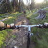
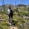
Along the way there will be smooth flow through glades, creek crossings, some respectable climbs, fast descents, glimpses of the valley, and usually the only crowd will be a few startled whitetails.
Think about wearing orange during hunting season. Those whitetails you probably saw make it popular with hunters.
I'd recommend riding Coyote Coulee counter clockwise. The beginning is not as steep and a lot of fun to start off the ride.
After heading up the trail about 100 yards comes the big decision: left or right. There doesn't seem to be a strong preference about which way to go. I tend to go right since going left starts the climb right off the bat and I prefer to warm up and save the bigger descent for the end.
Choosing the trail to the right,
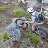
Lower Hayes Creek, you'll still be climbing for the next mile or so, but more gradually with some nice curvy sections to get you and your bike grooving together. The creek crossings here are rideable, but in the spring when the water is cold and high, using the bridges seem prudent. Cold wet feet from the almost the start just doesn't seem fun sometimes.
Around 1.5 miles the trail intersects a wide ATV trail. To stay on the trail turn right on the ATV trail and ride downhill for a couple hundred yards along with a few kelly humps for optional air before turning left back onto singletrack.
(One alternative at the ATV trail is to head uphill to the left to catch
Upper Hayes Creek. This can make for shorter loop back to trailhead if you head left on the upper trail, or a fun downhill to the junction with a right turn. Definitely a fun option, but the ATV trail itself isn't all that fun)
Assuming you stayed on the lower trail after the ATV trail, you'll be on an old railroad bed for short bit before hitting a steep but short downhill. In past years a goshawk used to nest here and would buzz you when riding past, but the nest appears vacant now. At the end of the downhill the trails meets up with the upper trail section of the Hayes Loop and the connector over to
Brown Jug. Left takes you back. Right continues the adventure.
The connecting trail over to the
Brown Jug loop is one of the more technical sections of trail. The are several sections of cobbled singletrack that you can either power over or around depending on your riding style. The trail is mostly downhill to Camas Creek. This creek crossing is a bit bigger that the previous ones. It can be ridden, although most people choose the bridge and dry feet. After crossing the creek, there is a short lung buster up to the
Brown Jug loop.
Now that I'm warmed up, I tend to head left and tackled the short steep climb to the top of the loop. At the top of the climb, 3.3 miles into the ride, there is a small clearing that makes a great place to stop and check out the view.
After a bit of rolling gradual climbing, the reward of nearly 1.5 miles of fast downhill flow deposits you at the low point of the ride. Get ready to climb for a while. 800 vertical feet separates you from the top of the ride. The first 0.7 miles is a relatively mellow climb to finish
Brown Jug. Retrace your tracks back across Camas Creek and up through the rocks to the Hayes Creek Loop.
Things should look a little familiar at 6.6. This is the junction with the Hayes Creek Loop. Stay right and keep climbing. This next bit of trail (
Lower Hayes Creek) is some of my favorite in either direction. The trail climbs through a scenic forest hollow before climbing out of the drainage, then climbs some more until hitting another section of old railroad grade that contours back to the ATV trail at 7.25 miles.
At this point the trail is "mostly" downhill, but not enough to drop your seat for the remainder of the ride. Remember those creek crossings early in the ride, well now it is time to cross those creeks again. This time there are no bridges, so get ready to get at least a little damp, and after each creek crossing there is a short climb back out.
After crossing the last creek at 8 miles, engage your dropper post and get ready for a fast descent back to the parking lot. This descent has some rock water bars and a challenging small ditch crossing that will make you glad that bikes now have suspension.
Originally created and maintained by the Bitterroot Backcountry Horsemen, the trail has become popular with hikers and cyclists in the valley.

 Continue with onX Maps
 Continue with Facebook


 Intermediate


 Ward Mountain
 Hamilton, MT
 Buttercup Loop
 Weasel Creek Loop


 Minor Issues


3 Comments