
 Continue with onX Maps
 Continue with Facebook


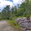
 Easy/Intermediate

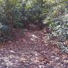
“A gravel road that connects Boyd Branch trailhead parking to Ledford Branch Road. ”


2.1
Miles3.4
KMDoubletrack
 Easy/Intermediate
Local Club: Pisgah Area SORBA
Land Manager: USFS - North Carolina National Forests Office
 Bent Creek Epicito v2
27.4 mi 44.2 km • 3,312' Up 1009.57 m Up • 3,323' Down 1012.85 m Down

 Bent Creek, NC
The Carolina Panther
Bent Creek, NC
The Carolina Panther
133.9 mi 215.5 km • 14,357' Up 4375.96 m Up • 14,332' Down 4368.3 m Down
Bent Creek, NC
 Fletcher Creek
9.5 mi 15.3 km • 712' Up 217.13 m Up • 719' Down 219.2 m Down
Avery C…, NC
Spencer Gap -Trace Ridge Loop
7.2 mi 11.6 km • 1,036' Up 315.83 m Up • 1,030' Down 313.85 m Down
Avery C…, NC
Pisgah Long Tour
27.2 mi 43.7 km • 3,591' Up 1094.45 m Up • 4,637' Down 1413.3 m Down
Mills R…, NC
The Great Eight
24.0 mi 38.6 km • 2,497' Up 761.2 m Up • 2,511' Down 765.26 m Down
Mills R…, NC


 All Clear


0 Comments