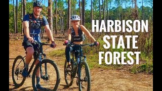
This is the main loop at Harbison State Forest. The trail starts and ends at the main parking lot. It is also the starting point for all of the other trails.
The trail is a mix of singletrack and fire roads. Leaving the parking lot (headed clockwise) the trail starts out as fairly wide singletrack. The park is frequently used by runners and walkers, so this section can be quite busy.
The first section contains some short climbs as well as some relatively fast descents. There is nothing super technical, but there are a few places where the trail threads between some relatively tight trees. There is also a short bermed section along the way.
The first section ends where the singletrack intersects a fire road. You'll turn right onto the fire road will keep you on the Firebreak trail. Going straight through the intersection will put you on the Firebreak connector trail (towards the
Stewardship Trail), and turning left will send you across
Lost Creek Drive to the
Lost Creek Loop.
Continuing right on Firebreak is a climb up a fire road. This will take you past a secondary parking lot, as well as restrooms. Once you start to descend, Firebreak will turn off the road to the right just past an open field. Staying to the left here will take you down to another parking lot and the beginning of the Midlands Mountain trial.
At this point there is a fairly fast descent with several water bars. It is easy to gain speed here, so be care is needed.
At the bottom of the descent, Firebreak crosses a gravel road and then a creek bed. The creek ranges from complete dry to several inches of water depending on recent rainfall.
After the creek crossing, Firebreak turns to singletrack again and starts to climb. Eventually it will intersect with another fire road and join Midlands Mountain. Firebreak continues to the right and the climb continues as well.
On this seciton, you'll pass
Crooked Pine on your right and Midlands Mountain on the left. This is one of the more open and sunny areas of the forest due to logging and controlled burns.
At the top of the climb Firebreak turns right off the fire road and turns back to singletrack. This final section passes the other end of
Crooked Pine and returns to the main parking lot.

 Continue with onX Maps
 Continue with Facebook


 Intermediate

 4.4 (16)


 Bad / Closed


0 Comments