MTB Project Logo

Something for everyone and more than just hills with marshland on one side and SF Bay on the other.


Your Rating: Rating Rating Rating Rating Rating      Clear Rating
Your Difficulty:
Your Favorites: Add To-Do · Your List
Zoom in to see details
Map Key

18.7

Miles

30.2

KM

10%

Singletrack

257' 78 m

High

6' 2 m

Low

605' 184 m

Up

605' 184 m

Down

1%

Avg Grade (1°)

14%

Max Grade (8°)

Dogs Unknown

E-Bikes Unknown

Family Friendly Miles of easy trails on both the marsh and bay sides with educational displays and programs at the visitor center. Shorten this ride to match abilities.

Overview

Coyote Hills seems like a world away while being right inside the bustling Bay Area and a hop, skip and jump (or bridge) from Silicon Valley. This ride includes nearly all the available trails and can be tailored to riders of all abilities.

Need to Know

Bring binoculars if you're into birdwatching.

Description

Practically a grand tour of this small regional park, this is a series of loops, including one into the neighboring national wildlife refuge with several return points for shorter or easier rides.

Starting from the visitor center parking area, take the Chochenyo Trail heading into the marshlands to the east. The marsh trails are perfectly flat so great for kids and casual riders. This ride includes an out-and-back detour on the D.U.S.T. Trail and Willows Trail to explore other parts of the marsh area.

Halfway into the Chochenyo Trail is a fenced-in native American (Ohlone shellmound) archaeological site that the trail loops around. The Tuibun Trail is a paved trail that runs parallel to the park entrance road returning towards the visitor center. Take the Muskrat Trail - singletrack that forks to the right returning to Chochenyo Trail to complete the marshland loop.

Backtrack a short distance to Lizard Rock Trail, which connects Chochenyo Trail to the paved Bayview Trail. This trail loops completely around the Coyote Hills from the marsh side to the bay side. Follow Bayview Trail counterclockwise and enjoy the views overlooking the salt ponds and SF Bay beyond. At the southern end, continue south on Apay Way, a dirt road with a couple viewpoint overlooks along the way. Turn around at any point making a right on Bayview Trail then a quick right on the Meadowlark Loop.

This loop returns to Bayview Trail and the No Name Trail, which heads directly west into the bay through the Don Edwards SF Bay National Wildlife Refuge. This is a straight-arrow levee road that runs along old salt-evaporation ponds ending at the north-south running Shoreline Trail. Head north on Shoreline Trail - be aware that the area is exposed to winds that can be strong especially in the afternoons and usually against the direction you're riding.

Shoreline Trail merges with the paved Alameda Creek Trail that turns east back towards Coyote Hills. In a little more than a mile, take the Pelican Trail going right (south). The trail starts near a pumping station and power pole. This trail is a lightly-used levee trail and as close to singletrack that you can find in this area. It rejoins Bayview Trail in about a mile where you turn left to the junction with Red Hill Trail on the right.

The Red Hill Trail climbs the series of hills that comprise the Coyote Hills ridge. It's a direct route up the spine of the hills and is quite steep in spots especially the final climb up Red or Glider Hill. It's worth the effort for the view that stretches from south bay all the way to San Francisco and Mount Tam when it's clear.

Continuing south, the trail hits a dead-end at another viewpoint just past the Soaproot Trail junction. Head down Soaproot Trail to return to the Quarry Staging area or visitor center via Bayview Trail.

Contacts

Shared By:

Bob Gardner

Trail Ratings

  4.1 from 20 votes

#1090

Overall
  4.1 from 20 votes
5 Star
40%
4 Star
30%
3 Star
25%
2 Star
5%
1 Star
0%
Recommended Route Rankings

#170

in California

#1,090

Overall
79 Views Last Month
13,648 Since Sep 3, 2016
Intermediate Intermediate

13%
21%
63%
0%
4%
0%

Photos

7:30am view of the sun coming up. Another stunning ride before work.
Feb 5, 2018 near Newark, CA
Had to take a break to take in this scene of the sunrise over the hills.
Feb 6, 2018 near Newark, CA
Start of my 7:30am ride before work. Stunning morning.
Feb 6, 2018 near Newark, CA
More from my 7:30am ride before work.
Feb 6, 2018 near Newark, CA
Coyote Hills Regional Park.
Sep 9, 2016 near Newark, CA
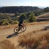
Red Hill trail.
Jul 15, 2018 near Newark, CA

0 Comments

Weather


Current Trail Conditions

All Clear 40 days ago
Add Your Check-In

Check-Ins

Jul 25, 2022
Ricardo J
Easy green trail if not for Red Hill which has steep descent.
Nov 21, 2020
Pedro Espinosa
Aug 24, 2019
Vince Serrano
Apr 19, 2019
Ryan Lee
5mi
Jun 9, 2018
Peg Hawkins
Trail conditions dry, good shape; was super windy (20+ mph gusts, no where to escape the wind! 7.5mi
May 19, 2018
Neal Manjeshwar
Easy trail. 1 difficult section called red wood hill. Great fun overall and great views. 18.7mi
May 19, 2018
Phani Pavuluri
Feb 10, 2018
Amit Mason
Stunning bay views up here
Welcome

Join the Community

Create your FREE account today!
Already have an account? Login to close this notice.

Get Started