MTB Project Logo

A super–scenic, high country singletrack ride along the Virgin River headwall.


Your Rating: Rating Rating Rating Rating Rating      Clear Rating
Your Difficulty:
Your Favorites: Add To-Do · Your List
Zoom in to see details
Map Key

13.7

Miles

22.0

KM

100%

Singletrack

9,765' 2,976 m

High

9,058' 2,761 m

Low

1,148' 350 m

Up

1,149' 350 m

Down

3%

Avg Grade (2°)

21%

Max Grade (12°)

Dogs Unknown

E-Bikes Unknown

Overview

A highly recommended ridge–line option leading around the beautiful Navajo Lake. Park and start at the Navajo Lake Loop Trailhead.

Description

The description below was likely posted before the new parking area was built at the East end of the lake just off the main road. Park at the new lot and start the loop counterclockwise around the north side of the lake.

Description:
To start, ride west on FR369 (backtracking), turn right onto the singletrack through Te–Ah campground and then left to FR053 (main road you drove in on). Take a right and ride for about 500 feet, turning left at the Virgin River Rim Trail.

Ride VRR trail, staying right at the first fork. Going left will take you down along the traditional southshore loop paralleling FR053. Staying right, you'll ascend to the top of the ridge. This trail is lesser–used and may have downed trees. We had to dismount and climb over quite a few, but it was totally worth the extra effort.

After a few miles, you'll have an opportunity to turn left on the Spruces Campground spur, but stay on VRR (straight) and climb up to the overlook area above The Saddle. The views from the high plateau are awesome, and the climb is moderately technical offering a nice intermediate–level challenge.

Continue south for a bit, then hang a left at the Dike Trail connector. From here, you drop rapidly back to the Navajo Lake Loop Trail #32022. Hang a right and follow this trail across FR053, through the lava fields, and back (westbound) along the swooping, quaking aspen–lined singletrack of the Navajo Lake northshore.

Contacts

Shared By:

Rob Moore with improvements by J R

Trail Ratings

  4.1 from 14 votes

#2

in Navajo Lake

#1861

Overall
  4.1 from 14 votes
5 Star
36%
4 Star
36%
3 Star
29%
2 Star
0%
1 Star
0%
Recommended Route Rankings

#2

in Navajo Lake

#90

in Utah

#1,861

Overall
15 Views Last Month
7,040 Since Jul 24, 2016
Intermediate Intermediate

9%
9%
55%
18%
9%
0%

Photos

Out of the woods and through the meadow to lava fields we go.....
Jun 24, 2013 near Parowan, UT
Extraordinary view w/Bay Area Crew!
Jul 24, 2016 near Parowan, UT
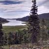
Navajo Lake looking east.
Jul 24, 2016 near Parowan, UT
The view is a good excuse for a break at the top of the ridge
Jul 29, 2020 near Parowan, UT
Along the North shore of the lake
Jul 29, 2020 near Parowan, UT
Looking back to the lake from the lava flow. The lake experiences low water by late summer many years with the east side drained by lava tubes.
Jun 24, 2013 near Parowan, UT
loading

Weather


Current Trail Conditions

Unknown
Add Your Check-In

Check-Ins

Jul 23, 2023
Alex Garhart
Nov 14, 2021
Brian Dilger
Fun little loop around the lake. Snow on Virgin Rim trail prevented me from riding farther. 9.4mi
Aug 24, 2020
Jasmine Board
Oct 26, 2018
Michal Ovsjannikov
Mudy and snow on VRR, great condition on the other side of the lake.
Aug 16, 2018
Chris Sarot
Had a BLAST! Two fallen trees across the trail...but lots and lots of hero dirt. Beautiful views for miles!
Jul 1, 2018
#deeznutzfosho
Jun 4, 2018
Martin Strong
Jun 2, 2018
stefan landwehr

Stewarded By

Welcome

Join the Community

Create your FREE account today!
Already have an account? Login to close this notice.

Get Started