
 Continue with onX Maps
 Continue with Facebook


 Intermediate/Difficult


 Intermediate/Difficult
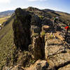
Local Club: Gunnison Trails
Land Manager: BLM Colorado - Gunnison Field Office
 Jack's Free Fall Loop
8.1 mi 13.1 km • 1,182' Up 360.42 m Up • 1,181' Down 360.01 m Down
Gunnison, CO
 Signal Peak Loop
21.8 mi 35.1 km • 1,955' Up 595.95 m Up • 1,944' Down 592.57 m Down
 Signal Peak Intermediate Loop
7.4 mi 12.0 km • 983' Up 299.71 m Up • 986' Down 300.48 m Down
Doctor Park
20.1 mi 32.3 km • 2,734' Up 833.47 m Up • 2,719' Down 828.71 m Down
Gunnison, CO
Tin Cup Pass Loop
66.7 mi 107.3 km • 7,674' Up 2338.91 m Up • 7,674' Down 2338.99 m Down
Alpine , CO
Colorado Trail: The Entire MTB Route - IMBA EPIC
549.3 mi 884.0 km • 71,117' Up 21676.5 m Up • 69,664' Down 21233.6 m Down
Roxboro…, CO


0 Comments