
 Continue with onX Maps
 Continue with Facebook


 Intermediate/Difficult
Intermediate/Difficult
Intermediate/Difficult
 Intermediate/Difficult
Land Manager: NPS - Santa Monica Mountains
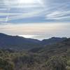
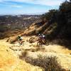
 Backbone Trail: Encinal Canyon
10.2 mi 16.4 km • 1,177' Up 358.71 m Up • 1,177' Down 358.72 m Down

 Thousan…, CA
 Zuma Loop
13.2 mi 21.2 km • 2,760' Up 841.17 m Up • 2,757' Down 840.46 m Down
Topanga Creek Outpost Loop
10.7 mi 17.3 km • 1,382' Up 421.1 m Up • 1,382' Down 421.23 m Down
Dos Vientos Tour
12.2 mi 19.7 km • 1,261' Up 384.48 m Up • 1,261' Down 384.3 m Down
Rancho Canejo Open Space Loop
3.9 mi 6.3 km • 670' Up 204.18 m Up • 675' Down 205.63 m Down
Sullivan Canyon to Sullivan Ridge Loop
8.9 mi 14.3 km • 1,440' Up 438.97 m Up • 1,438' Down 438.45 m Down
Santa M…, CA


 Minor Issues


2 Comments