
 Continue with onX Maps
 Continue with Facebook


 Intermediate

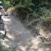
“A fast and fun trail that any rider can enjoy in either direction. ”


3.8
Miles6.1
KMDoubletrack
 Intermediate
Land Manager: USFS - Angeles National Forest Office
 La Tuna Loop
9.1 mi 14.6 km • 1,735' Up 528.7 m Up • 1,767' Down 538.71 m Down

 Super Strawberry
25.5 mi 41.1 km • 2,639' Up 804.51 m Up • 5,130' Down 1563.76 m Down
 Altadena, CA
Strawberry Peak Loop
Altadena, CA
Strawberry Peak Loop
15.6 mi 25.0 km • 2,593' Up 790.29 m Up • 2,603' Down 793.49 m Down
Altadena, CA
 Cherry Canyon
4.2 mi 6.8 km • 718' Up 218.7 m Up • 718' Down 218.7 m Down
El Prieto Loop
8.3 mi 13.4 km • 1,262' Up 384.6 m Up • 1,263' Down 384.89 m Down
La Caña…, CA
East Walker Ranch
3.0 mi 4.9 km • 352' Up 107.37 m Up • 352' Down 107.32 m Down
San Fer…, CA


5 Comments