MTB Project Logo

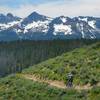
An Idaho Trail singletrack mountain segment.


Your Rating: Rating Rating Rating Rating Rating      Clear Rating
Your Difficulty:
Your Favorites: Add To-Do · Your List
Zoom in to see details
Map Key

36.5

Miles

58.7

KM

80%

Singletrack

8,503' 2,592 m

High

6,375' 1,943 m

Low

2,768' 844 m

Up

2,794' 852 m

Down

3%

Avg Grade (2°)

23%

Max Grade (13°)

Dogs Unknown

E-Bikes Unknown

Overview

This ride is the the eighth segment of the Idaho Trail. The Idaho Trail is a mountain bike friendly trail that extends from the Nevada border to Canada. It is a long-distance bike-packing or bike-supported trail. Each of the segments have been divided into what can be accomplished by an average rider in one day of riding. Since conditions can vary, please plan for possible delays. Where possible, the Idaho Trail follows the Idaho Centennial Trail (ICT), since the ICT was intended as a hiking trail there are deviations for Wilderness Areas and for more mountain bike friendly routes.

Need to Know

There is ample camping all along the route with only a couple tiny sections of private land. There are some supplies in the Bonanza area, but not a huge selection. It is recommended to stock up during the previous segment. Also, all the mountain segments when done as bike-packs should be done with the lightest gear possible that does not bog the bike down in technical sections. So pack light and travel fast.

Description

The eighth segment of the Idaho Trail starts with from the Custer Campground. Travel south on the Yankee Fork Rd. Next look for a right hand turn onto the West Fork of Yankee Fork road. You'll ride along this road a short ways before passing a guard station and then hitting the West Fork of Yankee Fork Trail.

The West Fork of Yankee Fork Trail begins behind the Bonanza Guard Station, off West Fork Yankee Trail Road, and starts with a half-mile section of ATV trail. After a half mile, the trail becomes singletrack for its remaining length. The ATV trail section has a short descent followed by a moderate uphill. Once you hit the singletrack, you'll finish the uphill and then descend into the creek bottom.

From here, the trail stays near the water over most of the length of the trail. You'll be going through a number of old burn areas, so be aware of the fact that there could be numerous trees down early in the season. There are no major water crossings, so you'll be able to keep your feet dry. The trail is easy riding with some short ups here and there. This portion also has some moderate rock features to ride over. As you near the end of the trail, it will become steeper as you climb to a forest service road near Hindman Lake. The trail will end at Red Mountain Rd and then you'll descend to Hindman Lake.

Then, you'll turn onto Hay-Knapp Creek (Western Segment). The western segment of the Hay-Knapp Creek trail begins near Hindman Lake. The trail climbs to a ridge overlooking the lake and the valley below. The climb can be steep in a couple of sections, but is manageable.

Once at the top of the pass, you'll begin with a steep descent on some switchbacks to the creek. Leaving the switchbacks, the trail will mellow out as you drop into flowing singletrack along the creek. There are some rocks to keep you on your toes, and a couple of short ups, but mainly the trail works its way down the drainage at a moderate grade.

At the end of this trail, you'll meet up with the doubletrack road. Follow this doubletrack down the drainage down to Valley Creek. Now, follow the forest service roads to the end of the segment at the Trap Creek Campground.

History & Background

The Idaho Trail was created to provide mountain bikers with a long distance trail option similar to the Idaho Centennial Trail.

Contacts

Shared By:

Chris Cook

Trail Ratings

  4.0 from 1 vote

#2939

Overall
  4.0 from 1 vote
5 Star
0%
4 Star
100%
3 Star
0%
2 Star
0%
1 Star
0%
Recommended Route Rankings

#105

in Idaho

#2,939

Overall
3 Views Last Month
968 Since Jan 18, 2016
Difficult Difficult

0%
0%
0%
0%
100%
0%

Photos

We went straight.  Taking a right at this point would have been considerably less painful but would also not have included the expansive views.
Aug 17, 2015 near Challis, ID

0 Comments

Weather


Current Trail Conditions

Unknown
Add Your Check-In

Check-Ins

none
Welcome

Join the Community

Create your FREE account today!
Already have an account? Login to close this notice.

Get Started