
 Continue with onX Maps
 Continue with Facebook


 Intermediate/Difficult
Intermediate/Difficult
Intermediate/Difficult
 Intermediate/Difficult
Land Manager: BLM - Otay Mountain Wilderness
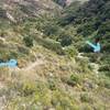
 Casian - #14 Extended Loop
11.6 mi 18.6 km • 1,276' Up 388.86 m Up • 1,276' Down 388.89 m Down

 La Cabaña Perdida - Extended Loop
24.9 mi 40.0 km • 2,451' Up 746.93 m Up • 2,449' Down 746.38 m Down
Las Del…, MX
Classic E-Ticket Route
5.4 mi 8.7 km • 593' Up 180.76 m Up • 591' Down 180.28 m Down
Tecolote Canyon Loop from Tecolote Road
11.6 mi 18.6 km • 585' Up 178.16 m Up • 584' Down 178.06 m Down
Eagle Peak Out-and-Back
9.0 mi 14.6 km • 1,933' Up 589.03 m Up • 1,933' Down 589.06 m Down
 Noble Canyon Round Trip
18.9 mi 30.5 km • 2,435' Up 742.32 m Up • 2,440' Down 743.63 m Down
Pine Va…, CA


3 Comments