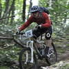
“A back country "rail trail" that is an easy climb out of the valley. ”
1.4
Miles2.2
KMSingletrack

Land Manager: PA DCNR - Moshannon State Forest
 Roth Rock Tour
26.6 mi 42.8 km • 2,692' Up 820.38 m Up • 2,694' Down 821.05 m Down


 Boalsburg, PA
 Rothrock TrailMix - IMBA EPIC
36.3 mi 58.4 km • 4,220' Up 1286.26 m Up • 4,215' Down 1284.59 m Down


 Boalsburg, PA
 Rothrock TrailMix Short Course
18.7 mi 30.1 km • 2,203' Up 671.51 m Up • 2,204' Down 671.73 m Down


 Boalsburg, PA
 Greenwood Furnace 13
13.3 mi 21.5 km • 1,512' Up 460.81 m Up • 1,512' Down 460.74 m Down


 Belleville, PA
 Greenwood Furnace - 20
19.9 mi 32.1 km • 2,500' Up 761.89 m Up • 2,500' Down 761.98 m Down


 Belleville, PA
 The Raven MTB Enduro Race, 2013 (public portion)
11.5 mi 18.6 km • 1,040' Up 317.12 m Up • 1,038' Down 316.36 m Down


 Milroy, PA


0 Comments