The Tanasi trail system is highlighted as a
Hall of Fame IMBA Epic ride and features miles and miles of flowing singletrack with fantastic views of the famous Ocoee River.
This ride features over 30 miles of singletrack with a few sections of forest service road to tie it all together. Be prepared to climb over 4000 vertical feet as you start high above the lake feeding the river, descend to river level, and then climb above it again...and back!
The ride starts and ends at the
Brush Creek trailhead directly adjacent to Highway 64. There is a very long, narrow parking area exactly 2.4 miles south of the Ocoee Whitewater Center.
Brush Creek,
Boyd Gap, and
Old Copper Road are ridden at the start and finish of the ride before crossing the Ocoee River at the Whitewater Center. The ride then includes virtually all of the Tanasi trails west of the river.
This ride exactly follows the Black Bear Rampage race course with one notable exception. The race course starts at the Ocoee Whitewater Center on Highway 64 and climbs 2.4 miles south on the highway to the
Brush Creek trailhead. This ride skips the road climb and instead starts and finishes at the
Brush Creek trailhead.
The
Brush Creek trailhead is just a few yards east of the eastern end of the long parking lot.
Start on
Brush Creek and ride the singletrack for 6.2 miles. This section features a lot of smooth, rolling trail with little climbing. There is one notable intersection at about 4.6 miles where the rider should go left. Taking a right at that intersection will simply return the rider to the parking lot..way too early!
Brush Creek ends at the Ocoee Gorge parking area at a metal gate. From the gate, go left 100 feet or so and pick up
Boyd Gap Trail. Descend
Boyd Gap for 0.7 miles to a paved road,
Number 3 Dam Rd. Go left on
Number 3 Dam Rd. and descend sharply to the Ocoee River put-in. This area is heavily traveled by kayakers.
Behind the changing rooms, pick up
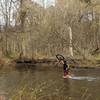
Old Copper Road. This wide singletrack trail follows the Ocoee just a few feet from the bank and features a couple stream crossings and some very rooty sections. It's not uncommon to ride along with whitewater rafters and kayakers as they navigate the rapids.
Old Copper Road ends at the Ocoee Whitewater Center. Cross the long foot/bike bridge to reach the west bank of the Ocoee and pick up
Bear Paw Loop. Now the climbing begins. Climb steeply above the bridge to the start of the loop and go right. 0.7 miles from the start of the loop, take a right onto
Chestnut Mountain Loop.
Follow
Chestnut Mountain Loop for 0.2 miles to the intersection of the actual loop. Go right to begin the counterclockwise loop. After about 2.9 miles of climbing, take a right onto
Thunder Rock Express. This is one of the best descents of the ride, with narrow singletrack, lots of exposure and tight turns. Finish on gravel road FS45 and get ready for some intense climbing.
Go left and climb FS45 for 0.8 miles to
West Fork trailhead on the left. Note that the trailhead is NOT at the top of the climb, so don't miss it. Descend
West Fork a bit before it begins to climb again. The trail switches back on itself several times and finishes back on
Chestnut Mountain Loop.
Stay on
Chestnut Mountain Loop for about a half mile before starting
Quartz Loop. Go left at the start of the loop and ride it clockwise.
Quartz Loop circles one of the highest points of the trail system before returning to
Chestnut Mountain Loop. After rejoining the trail, pick up
1330 Bypass and continue riding east for 0.9 miles.
The next few turns sound more confusing than they are. It's fairly clear while riding and there are trail signs. At the end of
1330 Bypass, go right onto
Chestnut Mountain Loop for about 200 yards and then go left on
River View Loop. Follow
River View Loop for 3.3 miles where it rejoins
Chestnut Mountain Loop. Go right to return to the start of the loop and then go right again to return to
Bear Paw Loop. You can take a right here to ride the short part of the loop you didn't ride when you climbed it or you can go left and ride the longer side to add more distance. Either way, you'll end up at the out-and-back you took up from the Ocoee bridge over the river. Descend back to the Ocoee Whitewater Center. From this point on, you are riding back the way you came in.
Cross the foot/bike bridge at the Ocoee Whitewater Center and go right to
Old Copper Road. Climb along the river back to
Number 3 Dam Rd. and go left. Climb the pavement to
Boyd Gap and go right for the hardest climb of the ride. Climb
Boyd Gap (remember how fun it was to descend it? Now you're paying for it on dead legs) to the Ocoee Gorge parking area. Pick up
Brush Creek at the metal gate to the right and return all the way back to the parking area.

 Continue with onX Maps
 Continue with Facebook


 Intermediate/Difficult

 4.6 (20)


1 Comment