Dogs Leashed


Trails close for 24 hours after rain. For current trail conditions, go to
tarheeltrailblazers.com
As of August 7th 2021, the park has now been re-opened! Additional singletrack is under construction.
Overview
Rocky Branch Park was originally built in 2013 by a local group of volunteers. The park was temporarily closed and renovated in 2020 with multiple machine-built flow trails and includes some of the original hand-cut singletrack.
The park connects two municipalities (The City of Belmont and the Town of Cramerton) through the main corridor, which is designated as part of the Carolina Thread Trail and is roughly 1.25 miles of gravel. The park is divided into five major skill-specific zones accessible via the thread trail or existing singletrack called Euler's Way.
The Canopy Trail is a biker-prioritized 1.15-mile beginner loop featuring optional jumps, berms, and features.
The Boulder Trail is a biker-prioritized 1.2-mile intermediate loop featuring optional and mandatory jumps, berms, and features and is open as of December 22nd 2021.
The Eagle Trail is another beginner biker-prioritized trail named Eagle and is a 1.2-mile trail with optional jumps, berms, and features. This zone is planned for construction and due in early 2022.
The Legacy Trail is a 1.1-mile hand-cut singletrack intermediate trail featuring optional drops, jumps, and berms and was part of the existing trail system.
The 4th and final zone is The Ravine Trail, a biker-prioritized 1.2-mile advanced trail due to be constructed in 2022
Need to Know
The main corridor of the trail is part of the bi-directional
Carolina Thread Trail and bikers should be aware of walkers, runners, and hikers and give them the right of way. In the event the thread trail is congested, there is singletrack trail called "Euler's Way" which runs parallel to the thread trail and provides an alternative route for bikers to use. Each trail zone has a clearly marked Hub which includes a trail map and a short description of the trail. These trails are biker prioritized, directional and clearly marked showing upcoming features and options.
Description
The park is accessible from three parking locations: The main trail entrance is at 220 Woodrow Ave, Belmont, NC, 28012, and has roughly 35 parking spots. The alternative trail entrances are at a Gaston County EMS Station: 700 Eagle Rd, Cramerton, NC 28012 which has eight parking spots, and at the Stuart Cramer High School: 101 Lakewood Rd, Belmont, NC 28012 which has multiple spaces. We do not recommend using the high school parking during regular school hours. The main park entrance has a water spigot (city water), a changing station, a park tool stand/tools, and benches. There is a small pump track close to the main entrance which is currently under renovation. The EMS Station on Eagle Rd and Main park entrance has large kiosks to show the park layout, maps, and rules.
The Carolina Thread Trail is a gravel conduit that runs through the middle of the park and provides access to each of the biking zones. It does have a loose surface, so use caution.
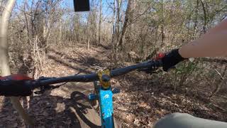
Euler's Way is a fun traditional single-cut trail that runs parallel to the Thread Trail with some fun jump features, bridges, and off-chamber corners. A fun segment on this trail is called "Beaver Run" which winds along the Rocky Branch Creek and has some faster rocky downhills and technical features. Euler's Way ends with a fairly long and technical climb, called "Power Line Climb" just before merging again with the Thread Trail. This is a point-to-point trail.
The Canopy Trail is a loop that has multiple features including skinny's, jumps, rock gardens, tabletops, large berms, drops, and transfers. It has been built as a green level trail with all of the features being optional. The goal of this zone is to introduce new riders to mountain biking with the trail being easy to ride, yet offer multiple more advanced features to skilled riders, so that everyone can enjoy the trail.
The trail starts with a climb running parallel with the creek to the top of the park. From the top, riders start the descent with multiple bermed corners and optional jumps and features. The trail then splits into two lines with one line having optional larger tabletops, jumps, and features. Both lines merge at the hub at the bottom, and riders can ride the trail again or continue to the next zone in the park. There is a bypass at the bottom of the trail which lets riders get to a small skills section on the lower split. This skills section has three variable height drops, a few berms, and jumps for bikers to session without having to ride to the top. This is a loop trail and the start and finish are next to each other.
The Boulder Trail is currently under construction (as of July 2021) and is estimated to be completed in the Fall of 2021.
The Legacy Trail is part of the existing singletrack trail before the park renovation, this 1.1-mile loop includes some mandatory and optional features and consists of drops, jumps, on intermediate and advanced technical singletrack. This is a point-to-point trail.
The Eagle Trail is currently under construction (as of July 2021) and is estimated to be completed in the Fall of 2021. This is a point-to-point trail.
The Tarheel Trailblazers are currently fundraising for the fifth and final zone, which is the advanced trail (Ravine), and once funded will take approximately three months to build. Please see the Rocky Branch Park website for more details.
Contacts
Shared By:
Vinnie Connors
with improvements
by Larry Conger
and 1 other

 Continue with onX Maps
 Continue with Facebook


 Intermediate/Difficult

 WWC East Main Full Tour


 WWC East/North/South


 All Clear


3 Comments