
 Continue with onX Maps
 Continue with Facebook


 Very Difficult
Very Difficult
Very Difficult
 Very Difficult
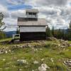
Local Club: Central Idaho Mountain Bike Association
Land Manager: USFS - Payette National Forest Office
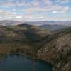
 Idaho Trail Segment 12
53.4 mi 85.9 km • 7,941' Up 2420.49 m Up • 7,575' Down 2308.95 m Down

 Blackwell Lake Loop
10.1 mi 16.2 km • 1,775' Up 541.08 m Up • 1,771' Down 539.73 m Down
 Cow Creek Loop
23.6 mi 37.9 km • 1,901' Up 579.4 m Up • 1,917' Down 584.36 m Down
 Bear Basin Tour
12.0 mi 19.3 km • 1,426' Up 434.69 m Up • 1,429' Down 435.68 m Down
Idaho Trail Segment 11
38.6 mi 62.2 km • 4,850' Up 1478.22 m Up • 2,894' Down 881.98 m Down
Idaho Trail: Segment 14
11.5 mi 18.4 km • 3,328' Up 1014.26 m Up • 4,203' Down 1281.01 m Down
Grangev…, ID


0 Comments