
 Continue with onX Maps
 Continue with Facebook


 Difficult

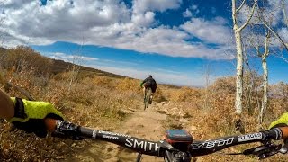
“Twist and shout through the aspens on this awesome trail. ”


3.1
Miles5.0
KMSingletrack
 Difficult
Local Club: Moab Trail Mix
Land Manager: USFS - Manti-La Sal National Forest Office
 Flat Pass
18.2 mi 29.2 km • 2,006' Up 611.44 m Up • 2,005' Down 610.98 m Down
 Porcupine Rim
14.7 mi 23.6 km • 1,195' Up 364.3 m Up • 2,962' Down 902.88 m Down
 Moab, UT
Hidden Valley / Moab Rim
Moab, UT
Hidden Valley / Moab Rim
6.7 mi 10.8 km • 1,039' Up 316.7 m Up • 1,654' Down 504.19 m Down
HyMasa/Captain Ahab
9.0 mi 14.5 km • 1,216' Up 370.51 m Up • 1,213' Down 369.69 m Down
Moab, UT
Poison Spider Loop Route
17.7 mi 28.5 km • 1,975' Up 602.11 m Up • 1,960' Down 597.41 m Down
Moab, UT
 Gateway Trails Tour
8.0 mi 12.9 km • 577' Up 175.89 m Up • 575' Down 175.18 m Down
Gateway, CO


2 Comments