The Yellow Trail, considered advanced along with the
Green Trail, is 6 miles of tough riding with climbs, technical areas, and swooping trails that use the surrounding terrain very well. It is recommended to travel in the direction shown above.
The Yellow Trail is all one trail but is divided into multiple sections. There are a few shortcuts to take; one that bypasses "Heartbreak Hill", one before the Boundary Trail, one before North Slope and one before the Goat Path. Trail descriptions follow the direction shown above.
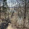
The entrance to the Yellow Trail is located at the intersection of the west terminus of Back Blue where it joins the Red Expressway. Your first challenge is the creek crossing across Hayne Branch. It looks simple enough, but the rock bed is pretty slimy. If you don't stay on your line, you're probably going down, so be careful!
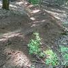
The first climb is "Heartbreak Hill" which is a slightly rocky climb with a tight switchback at the top followed by a quick fun descent sets the stage for what's to come. After that the trail winds through the "Boundary Trail" section, which runs along the boundary of MBSP. This climbs up to the top of "North Slope". This is a fast, flowy trail with a couple of climbs to keep you on your toes. On the 4th leg of this section is a wooden table top; speed up down the hill and get some air! After completing North Slope, the fun ends for a while as you climb up "Charlotte's Ridge." After completing that climb, you have a decision to make: take the shortcut to the main trail or go down "Goat Path."
Goat Path is a tough section with steep dips and climbs that can be fun as long as you keep your momentum up. After goat path, the trail takes you to "The Esses," a section that goes down a set of turns only to bring you right back up in a similar fashion, with 3-4 tight switchbacks. Next is "Chain Reaction" and "Flume Zoom," which are like a roller coaster along the same dip in the terrain. Keep the flow through these sections and it can be a blast. Finally you proceed to "Hornet Hill" and ultimately the yellow exit, which shares an exit corridor with the
Green Trail that connects back to the Red Expressway at it's west end.

 Continue with onX Maps
 Continue with Facebook


 Intermediate/Difficult


 Percy Warner Park Hookman Hill Loop


 The Park at Harlinsdale Farm


0 Comments