
 Continue with onX Maps
 Continue with Facebook


 Intermediate


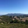
“A welcome addition of much needed singletrack in Marin County with spectacular views! ”


2.6
Miles4.2
KMSingletrack


2 Comments