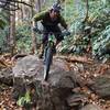
“A Forest Service road providing great link-up opportunities for area singletrack. ”
13.1
Miles21.0
KMDoubletrack

Local Club: Pisgah Area SORBA
Land Manager: USFS - Pisgah National Forest, Pisgah Ranger District
 Pisgah Stage Race - Stage 4
32.1 mi 51.6 km • 3,729' Up 1136.46 m Up • 3,728' Down 1136.34 m Down


 Brevard, NC
 Pisgah Stage Race - Stage 4
32.4 mi 52.1 km • 3,778' Up 1151.68 m Up • 3,774' Down 1150.17 m Down


 Brevard, NC
 The Great Eight
24.0 mi 38.6 km • 2,497' Up 761.2 m Up • 2,511' Down 765.26 m Down


 Mills R…, NC
 Cove Creek Loop
10.0 mi 16.0 km • 985' Up 300.16 m Up • 986' Down 300.58 m Down


 Brevard, NC
 Pisgah Stage Race - Stage 1
22.2 mi 35.7 km • 3,788' Up 1154.47 m Up • 3,793' Down 1156.05 m Down


 Brevard, NC
 The Couch Potato
25.1 mi 40.3 km • 3,564' Up 1086.38 m Up • 3,564' Down 1086.26 m Down


 Brevard, NC


1 Comment