
 Continue with onX Maps
 Continue with Facebook


 Intermediate/Difficult

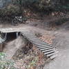
“A steep fire road at the top, narrow singletrack at bottom-gentle way to climb from bottom of park. ”


3.9
Miles6.4
KMDoubletrack
 Intermediate/Difficult
Land Manager: Midpeninsula Regional Open Space
 Scrambled Skeggs
13.8 mi 22.2 km • 2,416' Up 736.36 m Up • 2,431' Down 740.93 m Down

 Manzanita + Giant Salamander
8.5 mi 13.7 km • 1,387' Up 422.78 m Up • 1,387' Down 422.84 m Down
Portola…, CA
Waterdog Lake Park Loop
7.4 mi 12.0 km • 1,087' Up 331.21 m Up • 1,083' Down 330.03 m Down
 Old Haul Road Out and Back
11.5 mi 18.5 km • 768' Up 234.16 m Up • 760' Down 231.75 m Down
Portola…, CA
 Long Ridge Loop
6.0 mi 9.7 km • 689' Up 210.04 m Up • 689' Down 209.93 m Down
Saratoga, CA
Mid-Peninsula Linkup
26.9 mi 43.3 km • 4,011' Up 1222.64 m Up • 4,006' Down 1221.13 m Down


0 Comments