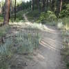
The ride up the Big Tesuque River canyon is on a beautiful forested trail and will have you crossing the river multiple times (approaching 20, be ready to get a little wet). Climbing through the forest at the higher elevations can be amount brilliant aspens if timed right or on a blanket of leaves.
The trails that make the top loop are forested while the trails that make up the lower loop are more scrub oak and desert in nature.
High traffic can be a draw back. Beware of those that shuttled and are flying down the
Winsor Trail as well as being careful yourself on the return trip. Additionally the first couple of miles can be busy with hikers as well as the loops at the top.
The
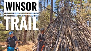
Winsor Trail is extremely popular as a shuttle ride starting from the Santa Fe Ski Area and heading down to Tesuque or into Santa Fe. Some of us either don't want to shuttle, don't have a spare vehicle to use or just prefer earning our downhill with sweat but don't want to ride a straight out and back.
Start up the
Winsor Trail following property fences to a road, make a left on the road to cross a bridge the a right back onto the trail. You eventually leave the houses behind and climb along the creek. When you come to an open climb with the creek on your right there will be a bridge to cross the creek, you can take either side, but if you cross the creek this is about where the Burn Trail 399 merges back with the
Winsor Trail at an unsigned junction. Continue up the canyon crossing the creek numerous times, eventually passing signed intersections with the Chamisa Trail 183,
Bear Wallow Trail 182 and finally coming to the
Borrego Trail 150 after a little less than 6 miles.
Make a right on the
Borrego Trail 150 and climb a steep narrow trail that has a few tight switchbacks along the way to a saddle. Once at the saddle you are at the high point of the ride. Start down the other side but keep your eyes peeled to the right as you'll soon make a 150 degree turn (if you are flying down it is going to be hard to see the sign post which faces the opposite direction) onto the
Bear Wallow Trail 182. Continue down the
Bear Wallow Trail 182 that has one very technical rocky spot, basically a short rock garden into a 3 foot drop on bench cut singletrack, botching things would have high consequences. Eventually you'll return to the
Winsor Trail and continue down to the junction with the Chamisa Trail 183, again if you are hauling you might miss the turn.
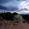
Another grueling climb with one very steep bit up the Chamisa Trail 183 takes you to the ridge and a 4 way junction. Hang a right onto the misleading Saddleback Trail. This trail more or less follows the RIDGE, though rarely on it, with many short sharp climbs. This trail is very narrow in places as it weaves through a scrub oak forest. There are several nice view points off of this trail. After a ways, you come to an unsigned junction with the "Burn Trail" or the "Juan Trail" (same trail, different name) This intersection, marked by a large but squat cairn, is easy to miss as the trail does not look like much. If you do you'll come to a large rock garden and begin descending towards Hyde Park Road.
On the Burn Trail 399, follow the tire marks, hoof prints and manure as it weaves among the trees. The trail becomes more worn in and eventually has a steep eroded descent, the type you would not want to ride up. More defending leads to a meadow with a small sign, make a right and go through the fence towards Tesuque Canyon (straight leads to an overlook). More tight singletrack with short climbs and descents leads back to the
Winsor Trail.
Head down the
Winsor Trail back towards your car being careful about controlling your speed because of other trail users.

 Continue with onX Maps
 Continue with Facebook


 Intermediate/Difficult

 Backdoor to Atalaya Mountain Views

 La Tierra Tortura

 Cerrillos Hills State Park


1 Comment