
 Continue with onX Maps
 Continue with Facebook


 Difficult
Difficult
Difficult
 Difficult
Local Club: Bald Eagle Area Mountain Bike Association (BEMBA)
Land Manager: PA DCNR - Bald Eagle State Forest
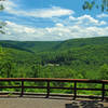
 The Western Territories Ride
24.3 mi 39.1 km • 2,301' Up 701.24 m Up • 2,300' Down 701.06 m Down


 McCall Dam and Cowbell loop
24.2 mi 39.0 km • 2,268' Up 691.32 m Up • 2,267' Down 690.93 m Down
 Raccoon Mountain Beginner Loop
6.5 mi 10.4 km • 390' Up 118.94 m Up • 390' Down 118.88 m Down
Penn Roosevelt Meander - 22
22.4 mi 36.1 km • 2,462' Up 750.4 m Up • 2,503' Down 762.9 m Down
Rothrock TrailMix - IMBA EPIC
36.3 mi 58.4 km • 4,220' Up 1286.26 m Up • 4,215' Down 1284.59 m Down
Boalsburg, PA
Coopers Gap Epic
27.3 mi 44.0 km • 2,654' Up 809.05 m Up • 2,655' Down 809.31 m Down
Belleville, PA


0 Comments