
 Continue with onX Maps
 Continue with Facebook


 Intermediate

 4.3 (23)

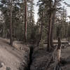
“Sage to Alpine and a grand view of the upper Owens Valley. ”


2.6
Miles4.2
KMSingletrack


2 Comments