
 Continue with onX Maps
 Continue with Facebook


 Intermediate

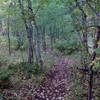
“An excellent singletrack trail that provides outstanding overlooks of southern Crook County. ”


2.9
Miles4.7
KMSingletrack
 Intermediate
Local Club: Sundance Chain Gang MTB Association
Land Manager: USFS - Black Hills National Forest Office
 Reuter to Sundance trailhead to Reuter
15.1 mi 24.3 km • 2,173' Up 662.34 m Up • 2,173' Down 662.22 m Down
 2 Flat Junction Ride
10.0 mi 16.1 km • 1,323' Up 403.12 m Up • 1,320' Down 402.48 m Down
Trail E - Carson Draw
5.2 mi 8.4 km • 605' Up 184.44 m Up • 613' Down 186.99 m Down
 Houston Creek Loop
9.1 mi 14.6 km • 1,286' Up 391.98 m Up • 1,286' Down 391.98 m Down
 Dugout Gulch Botanical Trail #77
8.6 mi 13.9 km • 1,050' Up 319.94 m Up • 1,060' Down 323.01 m Down
 Beulah, WY
Gold Dust Gravel Grinder
Beulah, WY
Gold Dust Gravel Grinder
72.9 mi 117.3 km • 4,693' Up 1430.43 m Up • 4,689' Down 1429.26 m Down
Spearfish, SD


0 Comments