
 Continue with onX Maps
 Continue with Facebook


 Intermediate
Intermediate
Intermediate
 Intermediate
Local Club: Tarheel Trailblazers
Apr 10, 2024: Purser Hulsey Dirt Day 4/13/24
Jan 8, 2024: 2024 Beatty workday program.
Nov 15, 2023: Back Yard Trail social Ride and Stump Jumper Raffle!!
Land Manager: City of Rock Hill, SC - Parks, Recreation and Tourism
 Triple Tip 2020
28.8 mi 46.4 km • 1,899' Up 578.93 m Up • 1,911' Down 582.49 m Down

 Ballantyne District Park
2.8 mi 4.5 km • 138' Up 42.18 m Up • 140' Down 42.67 m Down
Renaissance Park
4.0 mi 6.5 km • 303' Up 92.37 m Up • 318' Down 96.78 m Down

 WWC East Main Full Tour
5.3 mi 8.5 km • 361' Up 109.97 m Up • 359' Down 109.49 m Down
 Cane Creek Purple Trail
6.3 mi 10.1 km • 382' Up 116.52 m Up • 382' Down 116.55 m Down
George Poston Park
8.8 mi 14.2 km • 709' Up 215.98 m Up • 708' Down 215.9 m Down


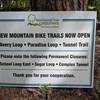
 Bad / Closed


4 Comments