Need to know: don't be fooled by the flume nature of this technical trail. Many advanced riders have gone down on this perched, narrow flume. This is not a great beginner trail, as it is technical, narrow, and consequences can be high.
In the early 1900's, water was diverted through Galena Ditch to be used by Stanley Revette's mines. 100 years later, it makes for a pretty cool bike ride!
From the Dredge parking lot along Tiger Road, cross the road to the south and begin a dirt road climb up
Summit Gulch Road. Climb approximately one mile past two homes and a drive on the right to the beginning of the trail on the left side of the road at a timber chicane.
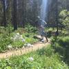
You'll ride along the top of the retaining bank (not in the ditch bottom), mostly along sharp mining rocks, and some packed dirt. Although dead level, there are steep slopes on both sides of the skinny trail, and a couple places require decent balance, so it's not really a beginner trail.
You'll pass several large mine tailings that the forest is slowly reclaiming.
After 1 3/4 miles, cross a primitive road (a downward left leads back to Tiger Road near Muggin's Gulch) and continue ahead on the ditch. In another 2/3 mile cross
Rock Island Road and continue to
Rock Island Trail. Cross
Rock Island Trail and continue another mile on newly constructed (2016) singletrack to Georgia Pass Road. The last mile of the trail is not along the historic flume, but is virgin singletracky goodness.
As you use the dirt roads to access this trail, you'll pass several confusing Private Property signs. Rest assured that you have every right to be on
Summit Gulch Road to access this trail.

 Continue with onX Maps
 Continue with Facebook


 Intermediate/Difficult


0 Comments