Dogs Unknown

E-Bikes
Unknown

This area can get overwhelmed with horse traffic and by June the trails can get easily wrecked. Keep other options in mind from July to October.
Description
2022 update: The Harmony Trail has indeed been slightly rerouted at the southern end, and now starts to the left of the Harmony Ridge Market building (as you face it), following the 09E02 forest trail.
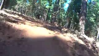
It is easy to find the trailhead. As pictured, the trail is signed here and there with a Blue Arrow. From the Harmony Ridge Market hub parking area, head up
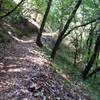
Pioneer Trail about 0.1 miles. There is a faint looking singletrack trail (not signed) to the left under a canopy of trees. The trail starts out nice and narrow and is overgrown in some parts. Here's the tricky part: at 0.5 miles, there is a large clearing where vehicles turn around. Look for tracks and a faint trail that makes a left and drops down a loose embankment to a narrow dirt road, then go right.
I've heard rumors this will, at some point, get a re-route. Continue on this route for about 1.67 miles where you'll veer right and climb a bit on the loosest section. Along the route there are several smaller trails leading off but just stick to the main route and keep right at the larger intersections. After a few easy climbs and flowing descents you're at mile 2.5 where the Harmony Trail ends on the Dascombe. At this point you can go left or right on the loop. Going right takes you down to Rock Creek and up toward Conservation Rd. To loop around, going left takes you back toward
Pioneer Trail and the Equestrian Staging area.
Contacts
Shared By:
Paul Rogers
with improvements
by Jenny Mo

 Continue with onX Maps
 Continue with Facebook


 Easy/Intermediate


0 Comments