MTB Project Logo

A fabulous loop covering some of Arizona's finest high altitude scenery and singletrack.


Your Rating: Rating Rating Rating Rating Rating      Clear Rating
Your Difficulty:
Your Favorites: Add To-Do · Your List
Zoom in to see details
Map Key

15.2

Miles

24.5

KM

40%

Singletrack

9,001' 2,743 m

High

8,139' 2,481 m

Low

1,198' 365 m

Up

1,209' 369 m

Down

3%

Avg Grade (2°)

13%

Max Grade (7°)

Dogs Unknown

E-Bikes Unknown

Overview

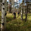
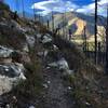
This outstanding loop takes in high altitude meadows, aspen glades, fabulous evergreen forest, and unbelievable views in the San Francisco Peaks. The ride lacks any technical challenges, but long and consistent uphill grades (at high elevation) make for a good workout. The reward is an ending that includes miles of fast flowing downhill on some of Arizona's finest singletrack.

Description

This ride can be traveled in either direction, and can start from any number of parking areas. As described here, the ride starts at the signed intersection of FR 151 (Hart Prairie Road) and FR 418. There is parking on the north side of this junction.

A counter-clockwise ride (described here) will take in the longest stretch of dirt road first, and allow full enjoyment of the swooping easy descent through aspen forest near the end of the ride.

From the parking area, head south on Hart Prairie Road (FR 151). This road climbs through forest and sees some traffic from cars and trucks. The road passes the intersection for the Bismarck Lake trailhead, and heads up along the shoulder of Fern Mountain and past the entrance of the Hart Prairie Nature Conservancy Preserve. Near here is an unexpected seasonal stream that flows through the aspens at the base of Fern Mountain. When running, this is a great spot to cool your heels.

Enjoy knockout views as you continue south on Hart Prairie Road to the signed but unremarkable intersection with FR 9215B. At this intersection turn east (left) and follow to little-used two-track up through a cattle gate. When the trail exits the forest and enters a meadow with nice views look for a well-traveled use trail near a "Closed to Motor Vehicles" sign. This heads uphill to Aspen Corner past Alfa Fia Tank (another nice spot to take a break!).

Just past Alfa Fia Tank at a well-signed trail junction, head north (left) on the Arizona Trail (Aspen Corner to FR 418). This five-star route is comprised of unsurpassed easy singletrack through meadows and aspen glades. The latter half of this trail is a long gentle descent swooping back and forth through beautiful forest. At the intersection with FR418 (a major well-traveled dirt road), head west back to your car.

Contacts

Shared By:

Almonzo Wilder

Trail Ratings

  4.4 from 44 votes

#376

Overall
  4.4 from 44 votes
5 Star
59%
4 Star
23%
3 Star
16%
2 Star
0%
1 Star
2%
Recommended Route Rankings

#22

in Arizona

#376

Overall
17 Views Last Month
27,912 Since Jun 8, 2014
Intermediate Intermediate

7%
12%
76%
5%
0%
0%

Photos

Aspen forest
Jun 21, 2015 near Flagstaff, AZ
No filter, don't need one - rider Dinno Domingo.
Jul 19, 2016 near Flagstaff, AZ
Aspens, ferns, boulders, biker and her bike.
Jul 19, 2016 near Flagstaff, AZ
Aspens, ferns and wildflowers.
Jul 19, 2016 near Flagstaff, AZ
MTBProject says no pictures of trail signs, but I say 'Viva La Revolucion!'
Jun 4, 2013 near Flagstaff, AZ
Cutting it up through one of the aspen sections!
Jun 26, 2020 near Flagstaff, AZ
loading

Weather


Current Trail Conditions

Unknown
Add Your Check-In

Check-Ins

Jul 29, 2023
Francy Hall
Oct 21, 2022
Eddie Goulette
Jun 4, 2022
Ren Sarantopulos
Aug 23, 2021
Denmex
17.9mi
Apr 18, 2021
Brice Corcoran
Sep 15, 2020
Katherine Lash
Sep 5, 2020
Helen Eifert
Missed a forest road turn & added a few extra miles 17.2mi — 2h 58m
Jun 28, 2020
Eck Doerry
Not terrible but it would be best to skip the rods. Go to end where intersects with 418, park, do out and back up the singletrack to aspen corner
Welcome

Join the Community

Create your FREE account today!
Already have an account? Login to close this notice.

Get Started