
 Continue with onX Maps
 Continue with Facebook


 Intermediate
Intermediate
Intermediate
 Intermediate
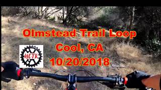
Local Club: Folsom Auburn Trail Riders Action Coalition
Land Manager: BLM California - Mother Lode Field Office
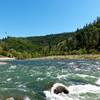
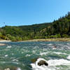
 Confluence to Maine Bar
10.3 mi 16.6 km • 1,159' Up 353.3 m Up • 1,160' Down 353.71 m Down


 ASRA 7 Mile Loop
7.4 mi 11.9 km • 1,095' Up 333.79 m Up • 1,095' Down 333.82 m Down
North A…, CA
Foresthill Divide
11.0 mi 17.6 km • 1,344' Up 409.78 m Up • 1,345' Down 409.85 m Down
Auburn…, CA
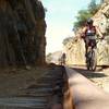
Skunk Hollow to South Fork ART (American River Trail)
14.1 mi 22.6 km • 1,693' Up 515.88 m Up • 1,697' Down 517.14 m Down
El Dorado Trail - Placerville to Folsom
32.6 mi 52.5 km • 436' Up 132.91 m Up • 1,874' Down 571.15 m Down
Jenkinson Lake aka Sly Park
8.2 mi 13.2 km • 680' Up 207.14 m Up • 657' Down 200.22 m Down


1 Comment