MTB Project Logo

Nice desert singletrack on gravel with moderate grades.


Your Rating: Rating Rating Rating Rating Rating      Clear Rating
Your Difficulty:
Your Favorites: Add To-Do · Your List
Zoom in to see details
Map Key

8.9

Miles

14.3

KM

100%

Singletrack

5,118' 1,560 m

High

4,682' 1,427 m

Low

534' 163 m

Up

532' 162 m

Down

2%

Avg Grade (1°)

9%

Max Grade (5°)

Dogs Leashed

E-Bikes Unknown

Overview

This fine singletrack ascends to a plateau with flowing turns and great views of "M Mountain" and the Rio Grande valley. The terrain is moderate with good switchbacks. The only technical challenges are occasional arroyo crossings and trail sections with loose gravel. The westernmost spur is a bit more chunky.

Need to Know

As of early 2024, the western segments of this trail (West of Lunch Loop) are closed during the construction of the SunZia Transmission Line. Please stay out of the active construction area.

The trailhead is on the road used for explosive shipments to New Mexico Tech research facilities. There is a gate on this road 1/2 mile south of the trailhead. This gate is typically locked during non-business hours. Unless you are located in Socorro, the best option is to take I-25 Exit 152 Escondida and then head south on the road to the trailhead. If you are in Socorro, it may be more convenient to park south of the gate and ride north 1/2 mile to the trailhead rather than driving all the way around.

A private landowner has generously granted access. Please be careful to keep the gate closed and stay on the trail to minimize impact.

Hikers and runners are frequent visitors. Please be alert and courteous to other trail users.

Description

The trailhead is on the west side of the NM Tech special delivery road--see Need to Know section. Please close and latch the gate behind you. Flat trail parallels the road for a ways, then crosses a fence stile and turns west.

The trail is a bit sandy and loose but quite rideable. It's easy to slide off on turns so please try to stay on the trail as the landowner is sensitive to this. The trail crosses arroyos and gradually ascends, becoming more gravelly.

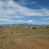
After about 2.5 miles the trail divides. Turning right is a shortcut that closes a lower loop. Turning left goes further west and enlarges the loop. The longer loop goes up onto an impressively flat and vast plateau. Endless S-turns make this a fun ride.

A western spur leads off the loop. This out-and-back crosses some chunky bedrock then goes west and ends abruptly at a canyon where property ownership changes.

History & Background

The Socorro Striders and Riders club negotiated access, established the trail, and maintains it. MTB Project publication is with the concurrence of the BLM land manager and the Socorro Striders and Riders.

Contacts

Shared By:

John Geronimo with improvements by Rob Selina

Trail Ratings

  3.9 from 25 votes

#1

in Socorro

#1074

Overall
  3.9 from 25 votes
5 Star
20%
4 Star
56%
3 Star
20%
2 Star
4%
1 Star
0%
Recommended Route Rankings

#1

in Socorro

#22

in New Mexico

#1,074

Overall
40 Views Last Month
4,323 Since Jan 31, 2014
Intermediate Intermediate

4%
4%
88%
4%
0%
0%

Photos

The plateau: flat but fun due to the many turns
Feb 1, 2014 near Socorro, NM
Fence stile and reminder that trail access is provided by a generous landowner
Jan 31, 2014 near Socorro, NM
Gate at the trailhead. Please be sure to keep the gate closed.
Jan 31, 2014 near Socorro, NM
Typical arroyo crossing with loose gravel and some erosion on the banks
Feb 1, 2014 near Socorro, NM
loading

Weather


Current Trail Conditions

All Clear 29 days ago
Add Your Check-In

Check-Ins

Join the Community

Create your FREE account today!
Already have an account? Login to close this notice.

Get Started.