
 Continue with onX Maps
 Continue with Facebook


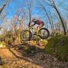
 Intermediate

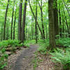
“A short rockier climb to the upper plateau. ”


0.3
Miles0.4
KMSingletrack
 Intermediate
Local Club: LHORBA - Laurel Highlands On & Off Road Bicycling Association
Land Manager: PaDCNR - Forbes State Forest
 Best of Laurel (Advanced)
20.4 mi 32.9 km • 1,128' Up 343.7 m Up • 1,126' Down 343.33 m Down

 Boswell, PA
 Circle of Jones Mill Run Valley
14.7 mi 23.7 km • 1,474' Up 449.28 m Up • 1,476' Down 449.87 m Down
Rich's Recommended Ride
13.1 mi 21.2 km • 914' Up 278.63 m Up • 913' Down 278.25 m Down
 Highland Intro
4.8 mi 7.7 km • 329' Up 100.14 m Up • 329' Down 100.3 m Down
Ohiopyle Quickie
2.9 mi 4.7 km • 321' Up 97.97 m Up • 317' Down 96.55 m Down
OP Singletrack Sampler
9.1 mi 14.6 km • 988' Up 301.16 m Up • 985' Down 300.31 m Down
Ohiopyle, PA


0 Comments