MTB Project Logo

Sections of existing doubletrack and new singletrack to complete your Pinhoti 1 ride.


Your Rating: Rating Rating Rating Rating Rating      Clear Rating
Your Difficulty:
Your Favorites: Add To-Do · Your List
Zoom in to see details
Map Key

8.7

Miles

14.0

KM

Doubletrack

2,843' 866 m

High

1,748' 533 m

Low

954' 291 m

Up

1,418' 432 m

Down

5%

Avg Grade (3°)

17%

Max Grade (10°)

Dogs Unknown

E-Bikes Not Allowed

Description

This trail is a side trail to the long distance Pinhoti trail, an IMBA epic. Parts of this loop actually include a portion of the Pinhoti known locally as P1. The rest of Pinhoti 1 is presented separately.

The trail starts at the top, although it can also be accessed from the Bear Creek forest road at its bottom.

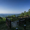
To get to the top, travel (by bike of course) up Potato Patch Road until you get to the scenic overlook (you'll know it when you see it). Just another few hundred yards uphill further there is a small parking lot that is the start of the trail.

It starts out as downhill singletrack, paralleling the road. After a few really tight switchbacks, it crosses a creek and joins an old doubletrack (no motorized vehicles). Although "just" doubletrack, this downhill section has lots of bends and turns and is a blast to take at speed. Just don't miss the turn off this doubletrack for the really fun downhill. This turn is actually at the endpoint of this trail as uploaded here. You'll notice it as the burned in track heads off to the right rather than turning back along the contour.

After a short doubletrack section, a great downhill singletrack starts. This is really fun.

After a large stream crossing, you'll technically be joining up with Pinhoti 1. P1 actually heads uphill to the left. Bear Creek/P1 continues on downhill paralleling (and sometimes crossing) the creek. You'll pass the huge poplar tree on your right that is worth a stop to marvel at.

Soon, P1 veers off uphill to the right, but Bear Creek continues downhill to Bear Creek Road, where there is also access to this trail.

The rest of this description describes the rest of Bear Creek Trail. however, this section usually isn't ridden as it is steep, less interesting doubletrack until it meets back with P1.

This section climbs up the east side of the valley and heads uphill north for about a mile and a half until it meets up with the uphill part of the P1 segment mentioned earlier. Bear Creek and P1 again follow the same tread (doubletrack) for a while until P1 exits to the right on a section not (yet) open to bikes. Bear Creek continues uphill along the contour back to where you left it earlier to get to the singletrack downhill.

Contacts

Shared By:

Jon Sundquist with improvements by Robert Sinclair

Trail Ratings

  4.3 from 24 votes

#3

in Mulberry Gap

#711

Overall
  4.3 from 24 votes
5 Star
58%
4 Star
25%
3 Star
8%
2 Star
8%
1 Star
0%
Trail Rankings

#3

in Mulberry Gap

#26

in Georgia

#711

Overall
63 Views Last Month
12,644 Since Jan 4, 2014
Intermediate/Difficult Intermediate/Difficult

0%
0%
50%
25%
21%
4%

Photos

Overlook
Mar 20, 2021 near Cherry Log, GA
Great view at sunrise!
Dec 24, 2020 near Cherry Log, GA
Rewarding view after the long climb up the forest service road.
Jul 11, 2016 near Chatsworth, GA
That's one big Tree!
May 22, 2013 near Ellijay, GA
Huge Gennett Poplar Tree
Mar 20, 2021 near Cherry Log, GA
Bear Creek Overlook.
Mar 20, 2021 near Cherry Log, GA
loading

Weather


Current Trail Conditions

Minor Issues 1 day ago
Add Your Check-In

Check-Ins

Aug 16, 2021
Candi Vera
Jul 22, 2021
Cole Maenza
May 13, 2021
Tom Conover
Mar 11, 2021
Micah Plimpton
8.7mi
Nov 23, 2020
Thomas Elm
Oct 25, 2020
Nikki Beverly Owen
Apr 26, 2020
Rosemary Milan
May 27, 2019
Don Williams
Welcome

Join the Community

Create your FREE account today!
Already have an account? Login to close this notice.

Get Started