
 Continue with onX Maps
 Continue with Facebook


 Difficult
Difficult
Difficult
 Difficult
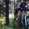
Local Club: Sundance Chain Gang MTB Association
Land Manager: USFS - Black Hills National Forest Office
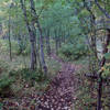
 Reuter to Sundance trailhead to Reuter
15.1 mi 24.3 km • 2,173' Up 662.34 m Up • 2,173' Down 662.22 m Down

 Bearlodge Cub Course
8.5 mi 13.6 km • 1,181' Up 359.97 m Up • 1,173' Down 357.66 m Down
Sundance, WY
 Bearlodge Mtn Classic Epic Course
22.5 mi 36.3 km • 3,256' Up 992.43 m Up • 3,255' Down 992.23 m Down
Gold Dust Gravel Grinder
72.9 mi 117.3 km • 4,693' Up 1430.43 m Up • 4,689' Down 1429.26 m Down
Spearfish, SD
Gold Rush Gravel Grinder
114.8 mi 184.7 km • 6,654' Up 2028.29 m Up • 6,648' Down 2026.37 m Down
Spearfish, SD
 Dakota Five-O Course
51.7 mi 83.3 km • 5,999' Up 1828.45 m Up • 5,999' Down 1828.55 m Down
Spearfish, SD


0 Comments