
 Continue with onX Maps
 Continue with Facebook


 Easy/Intermediate

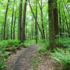
“A good introduction to riding in the woods and good for accessing other parts of the trail system. ”


1.0
Miles1.6
KMSingletrack
 Easy/Intermediate
Local Club: LHORBA - Laurel Highlands On & Off Road Bicycling Association
Land Manager: PaDCNR - Forbes State Forest
 Intro to Laurel
14.3 mi 23.0 km • 545' Up 166.21 m Up • 545' Down 166.12 m Down

 Best of Laurel (Advanced)
20.4 mi 32.9 km • 1,128' Up 343.7 m Up • 1,126' Down 343.33 m Down
 Boswell, PA
 Que Trail - Full Loop
16.1 mi 26.0 km • 1,129' Up 344.01 m Up • 1,129' Down 344.16 m Down
Jerome, PA
 Ohiopyle Shuttle Ride - Summit to Town
11.6 mi 18.7 km • 708' Up 215.86 m Up • 2,245' Down 684.41 m Down
New Skool Shuttle Banger
10.5 mi 16.9 km • 336' Up 102.44 m Up • 1,885' Down 574.67 m Down
Ohiopyle, PA
OP Singletrack Sampler
9.1 mi 14.6 km • 988' Up 301.16 m Up • 985' Down 300.31 m Down
Ohiopyle, PA


0 Comments