Dogs Off-leash

Features
Views
Overview
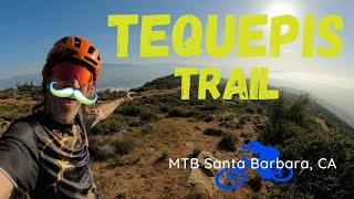
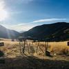
This is an out-and-back trail up to Camino Cielo just below Observation point. You get great views over the Santa Ynez Valley and Lake Cachuma all along, and at the top you're rewarded with even more breathtaking views of the frontcountry and the ocean!
This is a challenging, but almost completely rideable climb of just over 2300 feet. It's all singletrack beyond the first few hundred yards. There are no major technical difficulties, but a few sections are somewhat rocky and the climbing is consistently steep. The descent is wide-open and blazing fast, though!
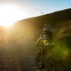
In the summer, this area gets very hot. An early start is advisable.
Need to Know
The trail is accessed from Hwy 154. Coming from Santa Barbara, you want to keep going on the Highway until you see Lake Cachuma on your right. There will be a number of turn-offs to your left; the one you're looking for is the last one before the Recreation Area on the right - watch for the sign indicating the Recreation Area in 3/4 mile, and then take the next to the left. There is a turning lane and a number of signs indicating camps ("Circle V Ranch Camp", "Rancho Alegre", "Camp Whittier"). Coming from the other direction, this will simply be the first exit to the right after the Lake Cachuma Recreation Area.
Once you've turned off Hwy 154, follow the dirt road to the left and just keep going for about a mile or two. You'll eventually reach the camp; park on the right just before the camp. To get to the trail, ride the road through the camp, keeping left. The road will eventually turn into Tequepis trail.
Description
After passing the camp, there's a bit of a fire-road section to a dry creek crossing, followed by a few short steep and technical climbing sections. The trail then opens up again and goes through a forested area, climbing fairly gently. After a very short loose section you start the long switchbacks that will lead almost all the way to the top. Most of the trail isn't too steep, but this has a few sections that are rocky and are challenging to climb, but certainly doable. At least you get great views from this entire section! After a few long switchbacks the trail gets a little more flat and less technical. About 15 minutes before you reach the top it gets wider and more forested again.
From the top, return the same way you came up. This will be really fast and flowy! Beware of hikers, though, especially since you can get really fast on this trail. Be sure to get a bike bell, distributed by the Santa Barbara Mountain Bike Trail Volunteers.
Contacts
Shared By:
Bela Bauer
with improvements
by James M
and 1 other

 Continue with onX Maps
 Continue with Facebook


 Difficult

 4.3 (27)


 All Clear


13 Comments