
 Continue with onX Maps
 Continue with Facebook


 Easy
Easy


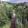
“A relatively easy side trip to the Hunter Fryingpan Wilderness Boundary. ”


1.5
Miles2.5
KMDoubletrack


0 Comments