
 Continue with onX Maps
 Continue with Facebook


 Easy/Intermediate

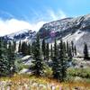
“A dirt road used to access some nearby rides. ”


4.3
Miles6.9
KMDoubletrack
 Easy/Intermediate
Land Manager: City of Durango, CO - Parks and Recreation
 Grandview Ridge & Horse Gulch Loop
15.8 mi 25.4 km • 1,674' Up 510.15 m Up • 1,683' Down 513.02 m Down

 La Plata Canyon
18.5 mi 29.8 km • 2,870' Up 874.83 m Up • 2,871' Down 875.05 m Down
 Hermosa Park Rd. > Hotel Draw > Stagecoach
12.1 mi 19.4 km • 1,833' Up 558.61 m Up • 1,831' Down 558.17 m Down
 The Whole Chicken
15.6 mi 25.1 km • 943' Up 287.31 m Up • 940' Down 286.47 m Down
 Road Apple Rally
30.1 mi 48.4 km • 1,885' Up 574.45 m Up • 1,883' Down 574.09 m Down
Colorado Trail: The Entire MTB Route - IMBA EPIC
549.3 mi 884.0 km • 71,117' Up 21676.5 m Up • 69,664' Down 21233.6 m Down
Roxboro…, CO


 All Clear


1 Comment