
 Continue with onX Maps
 Continue with Facebook


 Easy/Intermediate

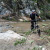
“A short singletrack descent connecting fire roads. ”


0.4
Miles0.6
KMSingletrack
 Easy/Intermediate
Land Manager: City of La Canada Flintridge, CA
 Gabrielino Trail: JPL to the USFS Dam
8.8 mi 14.1 km • 577' Up 175.77 m Up • 578' Down 176.14 m Down

 La Caña…, CA
Mt. Lukens from the Fire Station
La Caña…, CA
Mt. Lukens from the Fire Station
15.0 mi 24.1 km • 2,843' Up 866.4 m Up • 2,842' Down 866.24 m Down
 Stough Canyon
8.8 mi 14.2 km • 1,829' Up 557.5 m Up • 1,828' Down 557.26 m Down
La Tuna Loop
9.1 mi 14.6 km • 1,735' Up 528.7 m Up • 1,767' Down 538.71 m Down
 Winter Creek Loop
4.9 mi 7.9 km • 1,236' Up 376.75 m Up • 1,245' Down 379.49 m Down
Sierra…, CA
Hog Farm to Rattlesnake
6.5 mi 10.4 km • 870' Up 265.25 m Up • 868' Down 264.7 m Down


0 Comments