
 Continue with onX Maps
 Continue with Facebook


 Easy
Easy

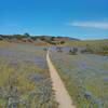
“A ridge road with some great views that takes you to the top of Trail 22 and Trail 60. ”


0.8
Miles1.3
KMDoubletrack
 Easy
Easy
Local Club: Monterey Off Road Cycling Association
Land Manager: BLM California - Hollister Field Office
 Best of Ord - Short
17.9 mi 28.8 km • 2,176' Up 663.12 m Up • 2,177' Down 663.56 m Down

 Salinas, CA
Couch Canyon
Salinas, CA
Couch Canyon
4.8 mi 7.7 km • 733' Up 223.41 m Up • 732' Down 223.18 m Down
Best of Nisene
18.6 mi 30.0 km • 1,951' Up 594.76 m Up • 1,945' Down 592.72 m Down
EMT, U-Con, Chinquapin, Pipeline
11.7 mi 18.8 km • 1,199' Up 365.55 m Up • 1,199' Down 365.48 m Down
Santa Cruz, CA
Circle Loop
18.5 mi 29.8 km • 1,259' Up 383.63 m Up • 1,269' Down 386.67 m Down
Santa Cruz, CA
 Wilder Ranch Coast Trail
14.3 mi 23.1 km • 144' Up 43.94 m Up • 144' Down 43.9 m Down
Santa Cruz, CA


0 Comments