
 Continue with onX Maps
 Continue with Facebook


 Easy
Easy

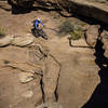
“An unappealing way to connect the two Klondike Bluff trailheads ”


2.9
Miles4.7
KMDoubletrack
 Easy
Easy
Local Club: Moab Trails Alliance
Land Manager: BLM Utah - Moab Field Office
 Tusher Tunnel - 3D Jeep Loop
25.6 mi 41.2 km • 1,478' Up 450.48 m Up • 1,475' Down 449.47 m Down


 Sovereign - Salt Wash Combo
10.6 mi 17.1 km • 871' Up 265.6 m Up • 870' Down 265.27 m Down
Hey Joe - Spring Canyon Loop
38.7 mi 62.3 km • 2,551' Up 777.41 m Up • 2,547' Down 776.22 m Down
 Hey Joe Safari Bikepack
99.0 mi 159.3 km • 5,545' Up 1690.05 m Up • 5,550' Down 1691.55 m Down
Intermediate Brands Loop
7.9 mi 12.7 km • 742' Up 226.25 m Up • 742' Down 226.09 m Down
Bar M Loops
10.9 mi 17.6 km • 720' Up 219.4 m Up • 719' Down 219.28 m Down


0 Comments