
 Continue with onX Maps
 Continue with Facebook


 Difficult

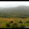
“A good extension to add some climbing and length to your ride. ”


1.7
Miles2.7
KMSingletrack
 Difficult
Local Club: San Diego Mountain Biking Association (SDMBA)
Land Manager: Oliven Hain Municipal Water District
 Coast to Crest Trail - North Shore Lake Hodges
15.6 mi 25.1 km • 407' Up 124.16 m Up • 407' Down 124.16 m Down

 La Costa Preserve - South Side Access
8.8 mi 14.1 km • 1,216' Up 370.54 m Up • 1,216' Down 370.49 m Down
Black Mountain Ranch West
4.8 mi 7.7 km • 297' Up 90.45 m Up • 738' Down 224.89 m Down

 Classic E-Ticket Route
5.4 mi 8.7 km • 593' Up 180.76 m Up • 591' Down 180.28 m Down
San Clemente Canyon
9.8 mi 15.7 km • 311' Up 94.93 m Up • 327' Down 99.67 m Down
Stone Mountain Trail
3.0 mi 4.9 km • 173' Up 52.77 m Up • 173' Down 52.68 m Down


 All Clear


0 Comments