
 Continue with onX Maps
 Continue with Facebook


 Intermediate

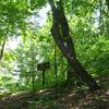
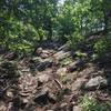
“Up and down, then up and down again with great flow. ”


2.3
Miles3.8
KMSingletrack
 Intermediate
Local Club: SORBA - Northwest Georgia
Land Manager: USFS - Chattahoochee-Oconee National Forest
 Johns Mountain
8.7 mi 14.1 km • 1,346' Up 410.15 m Up • 1,347' Down 410.55 m Down

 Berry HOD Loop
7.1 mi 11.4 km • 868' Up 264.52 m Up • 890' Down 271.39 m Down

 Brutal Loop 2
34.7 mi 55.9 km • 4,514' Up 1375.88 m Up • 4,517' Down 1376.73 m Down
Chatsworth, GA
Pine Log WMA Loop #1
9.9 mi 16.0 km • 1,088' Up 331.56 m Up • 1,085' Down 330.59 m Down
Rydal, GA
Iron Mountain Loop
11.8 mi 18.9 km • 1,149' Up 350.07 m Up • 1,148' Down 349.97 m Down
Benton, TN
Cohutta Death March
68.9 mi 110.9 km • 7,609' Up 2319.3 m Up • 7,616' Down 2321.3 m Down
McCaysv…, GA


0 Comments