Continue with onX Maps
 Continue with Facebook


San Gabriel Mountains
 CA
CA- Southern California
- San Gabriel Mountains


Recommended Routes in San Gabriel Mountains - 3
MTB Project is built by riders like you. Add Your Recommended Routes


 Easy
Easy
West Fork National Scenic Bikeway
14.5 mi 23.3 km • 948' Up 289.07 m Up • 948' Down 289.01 m Down

 Glendora, CA


San Gabriel Mountains Biking
- 68 Miles 109 Kilometers of Trail
- 3 Recommended Routes
- 1
Easy Trail

- 10
Intermediate Trails

- 2
Difficult Trails

MTB Project is built by riders like you. Share
what you know about this area!
Areas Within San Gabriel Mountains
Weather Averages
|
High
|
Low
|
Precip
|
Days w/
|
| J | F | M | A | M | J | J | A | S | O | N | D |
Trails in San Gabriel Mountains - 10
MTB Project is built by riders like you. Add Your Trails
15.7
mi
25.3
km
#1Sunset Ridge Truck Trail
 Intermediate/Difficult
Mount Baldy, CA
|
Intermediate/Difficult
|
Mount Baldy, CA |
4
|
|
13.8
mi
22.2
km
#2Silver Moccasin Trail
 Difficult
Littlerock, CA
|
Difficult
|
Littlerock, CA |
11
|
|
|
4.1
mi
6.6
km
#3Forest Road 3N06
Intermediate/Difficult
Mount Baldy, CA
|
Intermediate/Difficult
|
Mount Baldy, CA |
1
|
|
4.1
mi
6.5
km
#4Sunset Ridge Fire Road
 Intermediate
Mount Baldy, CA
|
Intermediate
|
Mount Baldy, CA |
3
|
|
|
5.9
mi
9.6
km
#5Barrett-Stoddard Truck Trail
Intermediate/Difficult
San Antonio Heights, CA
|
Intermediate/Difficult
|
San Antonio Heights, CA |
2
|
|
|
3.4
mi
5.4
km
#6Mt. Baldy Service Road
Intermediate
Mount Baldy, CA
|
Intermediate
|
Mount Baldy, CA |
1
|
|
|
7.6
mi
12.2
km
#7Upper Monroe Truck Trail
Intermediate
San Dimas, CA
|
Intermediate
|
San Dimas, CA |
6
|
|
|
3.9
mi
6.3
km
#8Glendora Ridge Motorway
Intermediate
Glendora, CA
|
Intermediate
|
Glendora, CA |
4
|
|
|
2.8
mi
4.5
km
#9Van Tassel Trail
Intermediate/Difficult
Azusa, CA
|
Intermediate/Difficult
|
Azusa, CA |
2
|
|
|
6.6
mi
10.5
km
#10Rincon-Redbox Road (2N24.2)
Intermediate
Bradbury, CA
|
Intermediate
|
Bradbury, CA |
1
|
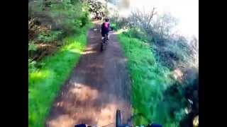
Photos of San Gabriel Mountains - 153
MTB Project is built by riders like you. Add Your Photos