
 Continue with onX Maps
 Continue with Facebook


 Intermediate


 Intermediate
Local Club: Groveland Trail Heads MTB Club
Land Manager: USFS - Stanislaus National Forest Office
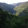
 Buck Meadows, Lumsden Bridge and the Toulumne River
17.5 mi 28.2 km • 2,810' Up 856.43 m Up • 2,811' Down 856.92 m Down
Tuolumn…, CA
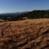
 Saw Mill Mountain Peak
8.9 mi 14.3 km • 1,367' Up 416.78 m Up • 1,368' Down 417.01 m Down
Mary Laveroni Community Park - Groveland, CA
3.6 mi 5.7 km • 473' Up 144.1 m Up • 463' Down 141.27 m Down
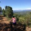
Pilots Peak Route
15.5 mi 24.9 km • 2,209' Up 673.31 m Up • 2,216' Down 675.49 m Down
Yosemite Valley Loop
10.4 mi 16.7 km • 291' Up 88.74 m Up • 298' Down 90.77 m Down
Yosemit…, CA
Devils Peak Ride (Signal Peak Lookout Tower)
24.4 mi 39.2 km • 3,327' Up 1014.18 m Up • 3,329' Down 1014.57 m Down


0 Comments